

Why Fell Forecasts Read Differently
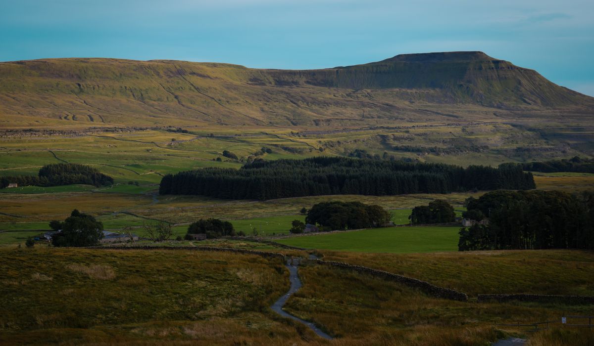
A forecast for the town at the foot of the valley tells you almost nothing about what is happening 800 metres above it. The weather on a British summit is genuinely different in kind: wind that is two or three times stronger, cloud that sits on the tops while the valleys bask, rain that arrives as sleet above the freezing level. Mountain-specific forecasts exist because general ones mislead. They give you summit wind speeds, cloud base in metres, freezing level and a precipitation picture for the tops rather than the car park. Learning to read them takes an evening or two, and it will change the walks you choose.
The single most useful habit is to read the mountain forecast for the region you are actually walking in, then adjust it for your route. A forecast for the eastern Lake District fells may be quite different from one for the western valleys, and the Cairngorms plateau can be savage while Aviemore is calm and mild.
Wind: The Number That Decides Your Day
Wind is the factor that most often turns a good day into a bad one, and it is the one most underestimated by walkers who only check the valley forecast. Summit wind speeds are quoted as a mean, with gusts alongside, and the gusts are what matter. A mean of 25 mph with gusts to 45 mph is a demanding day on an exposed ridge; a mean of 40 mph with gusts over 60 mph should have you reaching for a lower route or a different day altogether.
- Under 20 mph: a pleasant breeze, barely noticeable on sheltered paths.
- 20–30 mph: you will feel it on ridges and summits, and it will slow you down.
- 30–40 mph: walking becomes a fight; balance and concentration are constantly tested.
- Over 40 mph: on exposed ground you will be pushed off your line. Add rain or cold and the risk rises sharply.
Also check the direction. A westerly means shelter on the eastern side of a ridge and a buffeting on the tops; an easterly in winter often brings colder, drier air but a raw wind on the eastern fells. Wind funnelling through cols and around corrie rims can be far stronger than the forecast mean.
Cloud Base, Visibility and Navigation
Cloud base is given in metres above sea level, and it tells you what you will be able to see. If the cloud base is forecast at 600 metres and you are heading for a 900-metre summit, you will be in the cloud for the upper third of the climb. That is not a reason to stay home, but it is a reason to have your map, compass and a realistic plan.
Forecasts often note whether summits are expected to be clear, or give a percentage of tops likely to be cloud-free. That is more useful than raw cloud base, because it accounts for how cloud is expected to build through the day. In Britain, cloud often thickens during the afternoon, so an early start frequently buys you the views. Hill fog is the real navigational hazard: it removes landmarks, flattens depth perception and makes a familiar ridge feel like unfamiliar ground. If visibility is forecast below a few hundred metres, plan a route you can navigate by compass alone and know your escape lines.
Precipitation: Timing Matters More Than Totals
How much rain is forecast is less important than when it arrives. Two hours of heavy rain is a soaking; the same total spread thinly over a whole day is merely damp. Look for the pattern across the hours you plan to be out.
- Light rain or drizzle: wet, but manageable with good waterproofs.
- Moderate rain: paths turn greasy, streams rise, and rock becomes slippery. Expect to slow down.
- Heavy rain: rivers can become impassable at fords, and steep ground gets genuinely hazardous.
- Winter showers: snow above the freezing level changes everything; a rain forecast at valley level can mean deep snow on the tops.
Watch for thunderstorm risk too. On hot summer afternoons, convection can build over high ground, and being on an exposed ridge or beside a summit cairn is the last place you want to be. If storms are forecast, aim to be down by early afternoon.
Temperature, Freezing Level and Inversions
Temperature falls roughly one degree Celsius for every 150 metres of ascent, before wind chill is added. A mild 12°C at valley level becomes 6°C at 900 metres, and a 30 mph wind will make that feel close to freezing. Wind chill is the number to plan clothing around, not the valley temperature.
The freezing level tells you where rain turns to snow and where ice will form on rock and path. In winter, a freezing level of 600 metres means you may need crampons and an axe for the upper sections even if the approach is green.
Temperature inversions are the reward for the attentive. On calm, high-pressure days in autumn and winter, cold air sinks into the valleys and traps cloud below it, leaving the summits clear, dry and bathed in sun above a sea of cloud. These are magical days, but they come with still, cold air on the tops, and cloud that can creep upward through the afternoon. If an inversion is forecast, start early and be prepared for temperatures well below what the valley suggests.
Reading the Whole Picture Before You Set Off
Check the forecast the night before, and again in the morning. Look at the trend, not just the snapshot: is the wind rising or easing, is rain moving in or clearing? Have a primary route and a low-level alternative in mind, and decide at the car park which one the day deserves. Respect the numbers, keep an eye on the sky as you go, and remember that turning back is a decision to be pleased with, not embarrassed by. The fells will still be there next weekend.


Coding is used in almost all aspects of life and work now, be it directly or indirectly. It’s not just for companies in the tech sector. “An increasing number of businesses rely on computer code,
Coding is used in almost all aspects of life and work now, be it directly or indirectly. It’s not just for companies in the tech sector. “An increasing number of businesses rely on computer code,
Coding is used in almost all aspects of life and work now, be it directly or indirectly. It’s not just for companies in the tech sector. “An increasing number of businesses rely on computer code,